Information
- Publication Type: Conference Paper
- Workgroup(s)/Project(s):
- Date: November 2008
- ISBN: 978-3-85161-016-1
- Series: Tagungsreihe "Kulturelles Erbe und Neue Technologien" - Workshop "Archäologie und Computer"
- Note: Cultural Heritage & New Technologies
- Location: Vienna City Hall
- Lecturer: Claus Scheiblauer
- Booktitle: Proceedings of the 13th International Congress on Cultural Heritage and New Technologies
- Conference date: 3. November 2008 – 5. November 2008
- Keywords: laser scanning, virtual reconstruction, point-based rendering
Abstract
Range laser scanning evolved as a means for documenting buildings or archeological excavation sites. Point clouds resulting from these laser scans can consist of hundreds of millions of points. To get a clean model from this vast amount of data needs several person months. Instead we try to visualize the data directly, so archeologists can have a quick overview of the already scanned areas (e.g., during a scanning campaign). The models in our viewer are combined point clouds from several scan positions, and it is possible to add new point clouds to an existing model. We also allow for deleting points from the model. Furthermore we developed a heuristic to estimate point sizes, which enables the viewer to display surfaces as closed objects without a special preprocessing step. For the point size heuristic it suffices to know the positions of the points.Additional Files and Images
Additional images and videos
 Image:
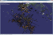
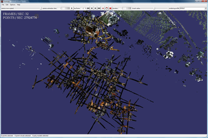
Overview of the Domitilla Catacomb model
Additional files
 Paper:
The paper submitted to the conference
Weblinks
No further information available.BibTeX
@inproceedings{Scheiblauer-2008-DCW,
  title =      "Domitilla Catacomb Walkthrough - dealing with more than 1
               billion points",
  author =     "Claus Scheiblauer",
  year =       "2008",
  abstract =   "Range laser scanning evolved as a means for documenting
               buildings or archeological excavation sites. Point clouds
               resulting from these laser scans can consist of hundreds of
               millions of points. To get a clean model from this vast
               amount of data needs several person months. Instead we try
               to visualize the data directly, so archeologists can have a
               quick overview of the already scanned areas (e.g., during a
               scanning campaign). The models in our viewer are combined
               point clouds from several scan positions, and it is possible
               to add new point clouds to an existing model. We also allow
               for deleting points from the model. Furthermore we developed
               a heuristic to estimate point sizes, which enables the
               viewer to display surfaces as closed objects without a
               special preprocessing step. For the point size heuristic it
               suffices to know the positions of the points.",
  month =      nov,
  isbn =       "978-3-85161-016-1",
  series =     "Tagungsreihe "Kulturelles Erbe und Neue Technologien" -
               Workshop "Arch\"{a}ologie und Computer"",
  note =       "Cultural Heritage & New Technologies",
  location =   "Vienna City Hall",
  booktitle =  "Proceedings of the 13th International Congress on Cultural
               Heritage and New Technologies",
  keywords =   "laser scanning, virtual reconstruction, point-based
               rendering",
  URL =        "https://www.cg.tuwien.ac.at/research/publications/2008/Scheiblauer-2008-DCW/",
}

 Paper
Paper