

Elitza Vasileva, Hsiang-Yun Wu
OptiRoute: Interactive Maps for Wayfinding in a Complex Environment
Poster shown at schematic Mapping Workshop 2019
(2019)
Information
- Publication Type: Poster
- Workgroup(s)/Project(s): not specified
- Date: April 2019
- Note: Best Poster Award
- Event: schematic Mapping Workshop 2019
- Call for Papers: Call for Paper
- Conference date: 2019
- Keywords: Maps, Route finding, Wayfinding
Abstract
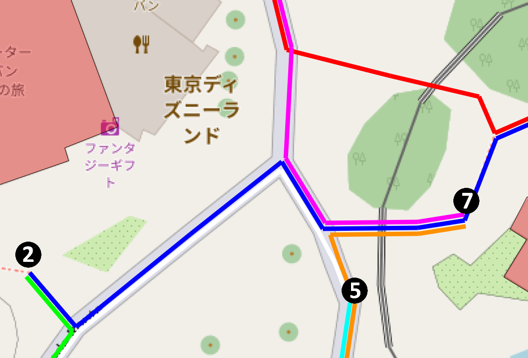
Visitors to amusement parks use mobile map appli- cations to decide where to go and to plan efficient routes. Such applications are especially helpful when visitors wish to avoid re-tracking their steps or visiting regions in the park several times. Visitors have limited time in the park, which typically covers a very large area, and the attractions have waiting times of varying duration. Time management is therefore important. In this paper, we propose a new visualization technique to support such route decision making, using an interactive environment. The main contribution of our system, OptiRoute, is the automatic computation of an optimal route between selected attractions as well as its effective visualization, which focuses on reducing visual clutter. This is achieved by improving the branch and bound route-finding algorithm, and introducing an intersection minimization algorithm for route representation. We demonstrate the feasibility of our approach through a case study of Tokyo Disneyland, in addition to a user study.Additional Files and Images

Weblinks
BibTeX
@misc{vasileva-2019-smw,
  title =      "OptiRoute: Interactive Maps for Wayfinding in a Complex
               Environment",
  author =     "Elitza Vasileva and Hsiang-Yun Wu",
  year =       "2019",
  abstract =   "Visitors to amusement parks use mobile map appli- cations to
               decide where to go and to plan efficient routes. Such
               applications are especially helpful when visitors wish to
               avoid re-tracking their steps or visiting regions in the
               park several times. Visitors have limited time in the park,
               which typically covers a very large area, and the
               attractions have waiting times of varying duration. Time
               management is therefore important. In this paper, we propose
               a new visualization technique to support such route decision
               making, using an interactive environment. The main
               contribution of our system, OptiRoute, is the automatic
               computation of an optimal route between selected attractions
               as well as its effective visualization, which focuses on
               reducing visual clutter. This is achieved by improving the
               branch and bound route-finding algorithm, and introducing an
               intersection minimization algorithm for route
               representation. We demonstrate the feasibility of our
               approach through a case study of Tokyo Disneyland, in
               addition to a user study.",
  month =      apr,
  note =       "Best Poster Award",
  event =      "schematic Mapping Workshop 2019",
  Conference date = "Poster presented at schematic Mapping Workshop 2019 (2019)",
  keywords =   " Maps, Route finding, Wayfinding",
  URL =        "https://www.cg.tuwien.ac.at/research/publications/2019/vasileva-2019-smw/",
}