

Silvana Zechmeister
Interactive Visualization of Vector Data on Heightfields
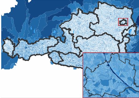
[image] [ Master Thesis] [
 Poster]
Information
- Publication Type: Master Thesis
- Workgroup(s)/Project(s):
- Date: October 2020
- Date (Start): 20. January 2020
- Date (End): 13. October 2020
- TU Wien Library:
- Second Supervisor: Daniel Cornel
- Diploma Examination: 13. October 2020
- Open Access: yes
- First Supervisor: Eduard Gröller

- Pages: 107
- Keywords: View-dependent Visualization, Vector Data Rendering
Abstract
The accurate visualization of huge amounts of georeferenced vector data on heightfields in real-time is a common problem in the field of geographic information systems (GIS). Vector data usually consist of lines and polygons, which represent objects such as roads, rivers, buildings, and parks. The interactive exploration of these vector entities in large-scale virtual 3D environments and the resulting large zoom range pose an additional performance challenge for their visualization. Ensuring clear visibility of all objects of interest in overview and of their details in close-up views is diÿcult in such large-scale environments. In this thesis, a screen-based visualization method of vector data is proposed, which combines two di˙erent approaches, a static and a dynamic approach, to control the behavior and the visibility of the corresponding vector entities. The vector data can represent real-world objects and to preserve their relative size to the rest of the 3D world, a constant object size is used for the static approach. But, this static behavior can cause vector entities to disappear when zooming out. Since lines are especially a˙ected due to their small width, the dynamic approach scales them according to the current view in order to be clearly visible even from far away. The evaluation results show that both screen-based visualization approaches can be applied in real-world use cases of a geospatial decision support system with large-scale environments and vector data consisting of several millions of vertices and still provide real-time performance. The results also highlight that the proposed screen-based visualization method produces larger render overheads compared with a volume-based visualization, but for large vector data sets, the new method outperforms it.Additional Files and Images


Weblinks
BibTeX
@mastersthesis{zechmeister2020,
  title =      "Interactive Visualization of Vector Data on Heightfields",
  author =     "Silvana Zechmeister",
  year =       "2020",
  abstract =   "The accurate visualization of huge amounts of georeferenced
               vector data on heightfields in real-time is a common problem
               in the field of geographic information systems (GIS). Vector
               data usually consist of lines and polygons, which represent
               objects such as roads, rivers, buildings, and parks. The
               interactive exploration of these vector entities in
               large-scale virtual 3D environments and the resulting large
               zoom range pose an additional performance challenge for
               their visualization. Ensuring clear visibility of all
               objects of interest in overview and of their details in
               close-up views is diÿcult in such large-scale environments.
               In this thesis, a screen-based visualization method of
               vector data is proposed, which combines two di˙erent
               approaches, a static and a dynamic approach, to control the
               behavior and the visibility of the corresponding vector
               entities. The vector data can represent real-world objects
               and to preserve their relative size to the rest of the 3D
               world, a constant object size is used for the static
               approach. But, this static behavior can cause vector
               entities to disappear when zooming out. Since lines are
               especially a˙ected due to their small width, the dynamic
               approach scales them according to the current view in order
               to be clearly visible even from far away. The evaluation
               results show that both screen-based visualization approaches
               can be applied in real-world use cases of a geospatial
               decision support system with large-scale environments and
               vector data consisting of several millions of vertices and
               still provide real-time performance. The results also
               highlight that the proposed screen-based visualization
               method produces larger render overheads compared with a
               volume-based visualization, but for large vector data sets,
               the new method outperforms it.",
  month =      oct,
  pages =      "107",
  address =    "Favoritenstrasse 9-11/E193-02, A-1040 Vienna, Austria",
  school =     "Research Unit of Computer Graphics, Institute of Visual
               Computing and Human-Centered Technology, Faculty of
               Informatics, TU Wien",
  keywords =   "View-dependent Visualization, Vector Data Rendering",
  URL =        "https://www.cg.tuwien.ac.at/research/publications/2020/zechmeister2020/",
}